National Waffle Day

National Waffle Day is celebrated on August 24, the date in 1869 on which when Cornelius Swarthout of New York received the first U.S. patent for a stovetop waffle iron. The word "waffle" first appeared in the English language more than a hundred years earlier, in 1725; waffles had been a not-uncommon food, particularly among Dutch immigrants, but Swarthout's waffle iron added a shorter handle and clasp to make flipping easier.

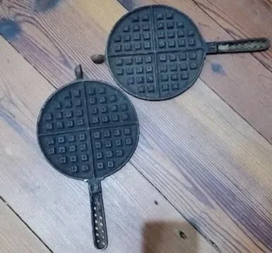
We have several waffle irons in our Museum collection, though they all date to eras post-U.S.-patent. This simple cast iron waffle maker is likely the oldest, from the 1870s or 1880s. There are no makers marks or labels, and the pin is missing from inside the rotation area. The iron would be placed over the coals and then flipped halfway through cooking. See it on display in our 19th-century kitchen.

98.12.1

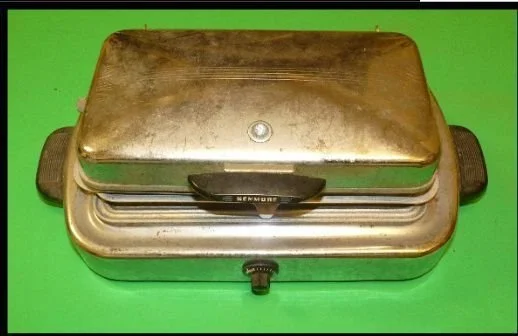
By the 1910s, General Electric and other companies were experimenting with electric waffle irons like we use today. This 1940s electric Sears Kenmore waffle iron was donated to the Museum in 1998. The Bakelite - an early plastic - handles are brittle but intact. The waffle iron worked when it was donated, but we haven’t tested it since!

Will you celebrate National Waffle Day with some of the treat?

Artifact Spotlight: William Moultrie's signatures

William Moultrie is known across the country for his part in the American Revolution. You’ve likely visited (or at least heard about) Fort Moultrie on Sullivan’s Island, South Carolina. You may have even visited the cenotaph for the two-time governor in Saint James, Goose Creek churchyard. But did you know that the Berkeley County Museum has two different documents with his signature?

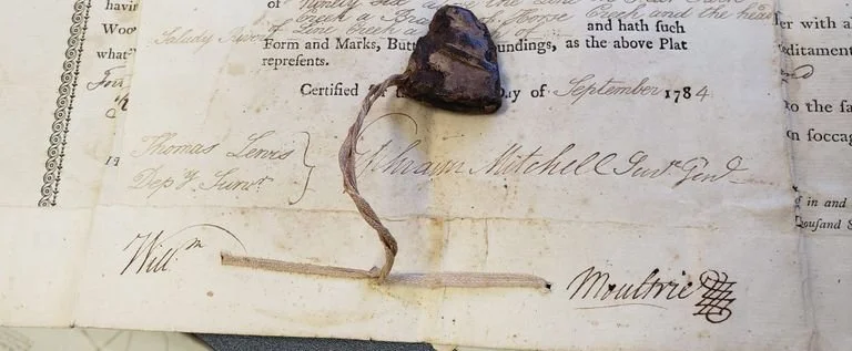
Both documents are land grants or land-related transactions. The older of the two, dated to September 1784, lays out 640 acres in the Ninety-Six District for Richard Gough. Moultrie, lieutenant governor at the time, signed the plat.

MSS1.10.28

The partial wax seal attached is presumed to be Moultrie’s, but it is unconfirmed. The plat is also signed by Deputy Surveyor Thomas Lewis and Surveyor General Ephraim Mitchell.

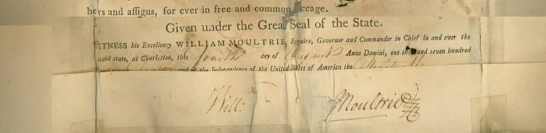
The second Moultrie signature in the Berkeley County Museum collection comes from 1794, when he was ending his first term as governor. This plat is for land in the "Washington District" of South Carolina, which included the modern counties of Anderson, Pickens, and parts of Greenville.

94.1.1

This signature came into our collection with a large wax Seal of South Carolina. The seal was first used in 1777; by the mid-1780s, the double-sided nature of the seal had become cumbersome, so a single-sided seal was introduced. The seal in the Museum collection is double-sided. The 1794 document shows shadowing, evidence of potential seal use, but it is unknown whether it was the double-sided version.

Both of these wonderful signatures are currently on display at the Museum. Find them near the Revolutionary War kiosk.

Artifact Spotlight: "Columbia Calls" recruitment poster

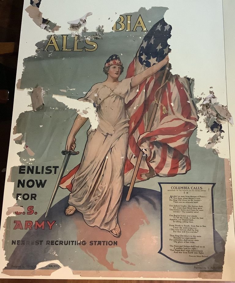
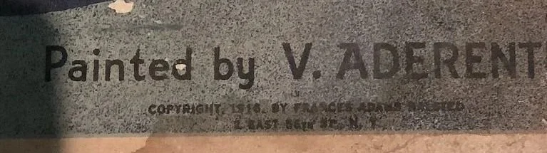
The focus of today’s Artifact Spotlight is this World War I “Columbia Calls” recruitment poster.

MSS29.1.1

Convinced that the US entering the war was inevitable, Frances Adams Halsted wrote a poem, Columbia Calls, in 1916. After America entered World War I on April 6, 1917, Halsted donated her poem and accompanying image design to the U.S. War Department. Three months later, the New York Times announced plans to print 500,000 copies as a poster; over one million copies were eventually printed. This poster therefore dates to about that year.

The poster is torn on the bottom right and the corner is missing, but most of the text remains. The original poster was painted by Vincent Aderente.

The poster was found in the Museum’s map cabinet with no provenance or donation information - if you know the donor, please let us know! Unfortunately, our copy of this poster is in extremely poor condition and cannot go out on display.

Artifact Spotlight: Gaillard Map

This is part one in a new blog series called “Artifact Spotlight.”

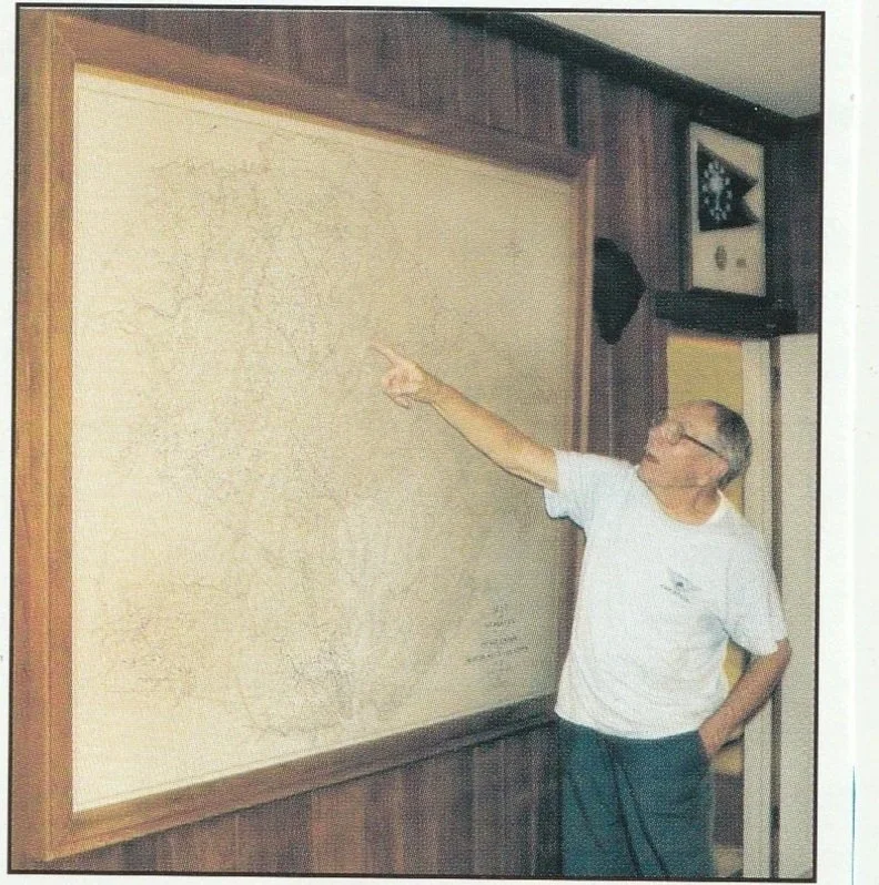
Upon walking into the Museum, one of the first things people see is the Gaillard Map hanging proudly on the wall. This map was donated in 2005 by the late former Charleston Mayor J. Palmer Gaillard, Jr.

Donor J. Palmer Gaillard Jr. points to Lake Moultrie on the large map. The photo was taken prior to the donation in 2005.

The map was first created in 1926 by Gaillard’s father, the late J. Palmer Gaillard (1874-1962). The senior Gaillard was a civil engineer and land surveyor. He worked for Harza Engineering of Chicago to do extensive surveys of the land that would become part of the Santee Cooper Project. Santee Cooper hired Harza (and Gaillard) in the summer of 1938.

The map was updated over the years, with the final changes coming in 1955. Landmarks such as the Santee Cooper Lakes and the Tailrace Canal were added as they were constructed. Most of the names of people and properties shown on the map date to the 1920s, giving a snapshot into the area before the Lakes.

Stop in soon to see the 6-foot map in all its glory, and see how many names you recognize on it!