William Moultrie is known across the country for his part in the American Revolution. You’ve likely visited (or at least heard about) Fort Moultrie on Sullivan’s Island, South Carolina. You may have even visited the cenotaph for the two-time governor in Saint James, Goose Creek churchyard. But did you know that the Berkeley County Museum has two different documents with his signature?
Both documents are land grants or land-related transactions. The older of the two, dated to September 1784, lays out 640 acres in the Ninety-Six District for Richard Gough. Moultrie, lieutenant governor at the time, signed the plat.
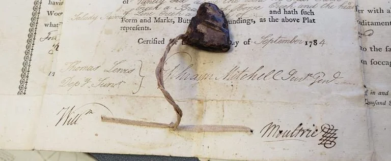
MSS1.10.28
The partial wax seal attached is presumed to be Moultrie’s, but it is unconfirmed. The plat is also signed by Deputy Surveyor Thomas Lewis and Surveyor General Ephraim Mitchell.
The second Moultrie signature in the Berkeley County Museum collection comes from 1794, when he was ending his first term as governor. This plat is for land in the "Washington District" of South Carolina, which included the modern counties of Anderson, Pickens, and parts of Greenville.
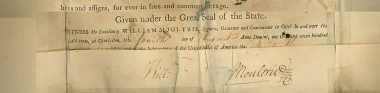
94.1.1
This signature came into our collection with a large wax Seal of South Carolina. The seal was first used in 1777; by the mid-1780s, the double-sided nature of the seal had become cumbersome, so a single-sided seal was introduced. The seal in the Museum collection is double-sided. The 1794 document shows shadowing, evidence of potential seal use, but it is unknown whether it was the double-sided version.
Both of these wonderful signatures are currently on display at the Museum. Find them near the Revolutionary War kiosk.