This Saturday, October 3, is the Berkeley Modern Quilt Guild’s third annual Airing of the Quilts. In many places this is a spring tradition - freshening the quilts after they’ve been in use for the long winter - but the BMQG fall version makes sense too: who wants to use a quilt if it smells like the closet it was kept in all summer?
Ahead of the event on Saturday, we wanted to take a look at some of the quilts in the Museum collection.
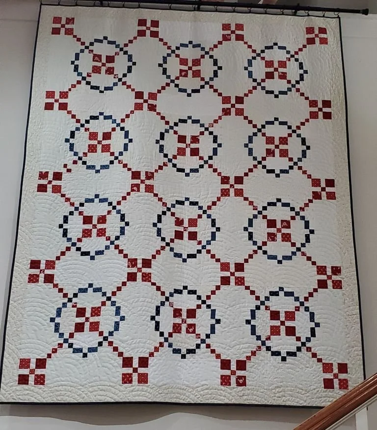
26.3.1
Our most modern (or most recently created) quilt is the “Burgoyne Surrenders” quilt hanging in the Museum lobby, which was made in 2025-2026 by the Berkeley County Quilters in honor of the 250th anniversary of the United States' founding. This quilt pattern, also known as the “Burgoyne Surrounded,” is said to be inspired by the defeat of British General John Burgoyne in 1777 at Saratoga, New York. Burgoyne’s troops are represented by the center squares, surrounded by American forces. This pattern first became popular in the late 1800s and early 1900s, perhaps around the time of the centennial of the Revolution.
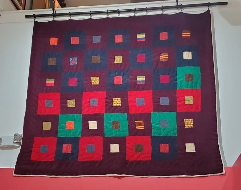
L23.12.8
Our next quilt is on display in the Indigenous South Carolinians exhibit. It is on loan from former Wassamasaw Tribe of Varnertown Indians Spiritual Leader Loretta Clark Leach, granddaughter of Geneva Varner Clark. Geneva Varner Clark (1905-1975) was a matriarch of the Wassamasaw Tribe. In 1938, WPA photographer Marion Post Wolcott photographed Clark and three of her children. Varner identified as Native American, referring to herself as a “Summerville Indian.” The photos by Post are the only known photos of members of a Lowcountry Indigenous community housed in the Library of Congress.
95.9.1
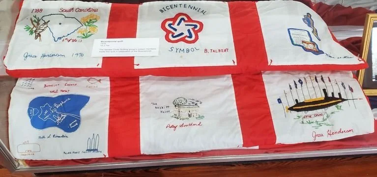
Finally, the bicentennial quilt was recently removed from our temporary exhibit 1776/1976/2026 and returned to collections storage. This quilt was made by the Santee Circle Quilters (also known as the Santee Circle Home Demonstration Club) in 1976. The squares display different aspects of Berkeley County history and give the names of the sixteen quilters.